Home » 2015 » June » 24 » Latest EU Sentinel satellite to track global food crops
1:37 PM
Latest EU Sentinel satellite to track global food crops
Latest EU Sentinel satellite to track global food crops
The lead spacecraft in Europe's new multi-billion-euro Earth observation programme has gone into orbit.
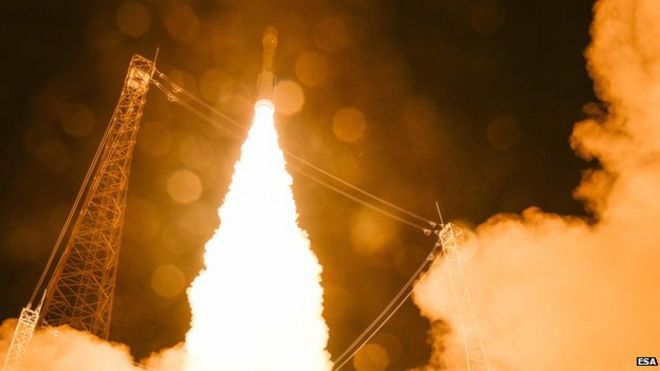
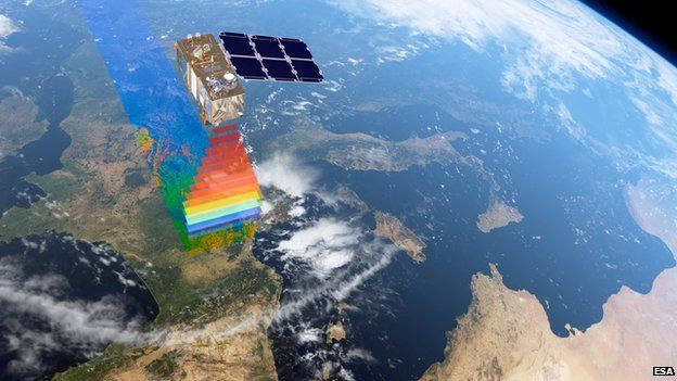
Known as Sentinel-2a, the satellite was sent up on a Vega rocket from Kourou in French Guiana.
The mission will return pictures of the planet's surface in visible and infrared light.
Its data will map everything from the growth of megacities to the destructive aftermath of natural disasters such as earthquakes.
But Sentinel-2a will also have a particular role in monitoring the performance of the world's food crops.
Its camera sensor has been designed to detect very specific wavelengths of light that detail the health of plants.
This should give international agriculture and food agencies advance notice of poor harvests and the potential for famine.
"We have 13 spectral bands including four in the so-called 'red edge' where plants, and chlorophyll for example, reflect light - and this shows us what plants are doing," explained Prof Volker Liebig, the director of Earth observation at the European Space Agency (Esa).
"This is especially important for food monitoring and, for me, food security applications will be among Sentinel-2's most important uses.
"It will help the World Food Programme forecast bad harvests, and reduce, let's say, speculation on world food markets, which always costs lives because it sends prices skyrocketing even when there are enough cereals to go around," he told BBC News.
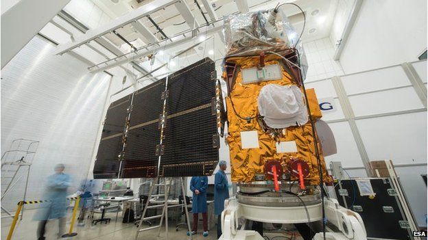
The new 1.1-tonne satellite's Vega rocket lifted away from Europe's spaceport in Kourou, French Guiana, at 22:51 local time, Monday (01:51 GMT; 02:51 BST Tuesday). Sentinel-2a was reported to have separated from the Vega just under an hour later, with ground controllers in Germany then able to confirm the successful deployment of the spacecraft's solar array.
The Sentinel is expected to begin operations in three or four months' time, after it has been thoroughly checked out and its instrument properly calibrated.
Sentinel-2a is part of a series of space sensors to be launched by the start of the next decadeThis simulation depicts how differences in vegetation will be seen, including chlorophyll content
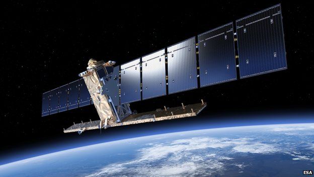
Sentinel-2a is one of six sensor types being launched over the next few years by the European Union as part of its Copernicus project.
But given the emphasis on visible/optical imagery in Earth observation, it is possible to think of Sentinel-2 as the primary platform in the series.
The first to go up was actually a radar satellite. Sentinel-1a launched in April 2014 and specialises in detecting land movements.
The remaining sensors yet to fly will focus on the oceans and the atmosphere.
The game plan is to have two of every satellite or sensor in orbit at any one time.
Hence, Sentinel-2b will launch in the October to December timeframe of next year.
By pairing spacecraft, controllers can reduce the time it takes to re-visit a particular location. And for the colour camera on Sentinel-2, this is important because it cannot see through cloud.
A rapid return to a location raises the chances of getting a clear shot of the ground.
"With two satellites, we have a re-visit over the equator every five days, and at mid latitudes - like over France and the UK - it is every three days," said Esa's Sentinel-2 project manager, Francois Spoto.
"This is an extremely frequent re-visit time compared with any sensor currently in orbit. And in our spectral bands, we also have one that allows us to remove light clouds like cirrus."
Both Sentinel-2 satellites have been manufactured by a more than 40-strong consortium of European companies led by Airbus Defence and Space.
"Sentinel-2 includes a number of technology breakthroughs," said Airbus executive Dr Mike Menking.
"Its instrument incorporates the largest monolithic silicon-carbide structure engineered to date, and along with a very precise low-disturbance attitude and orbit control system ensures extremely high-quality imagery," he told BBC News.
Sentinel-2a is equipped with a laser to downlink its pictures at a rapid rate.
Sentinel-2 can be thought of as the primary satellite in the series
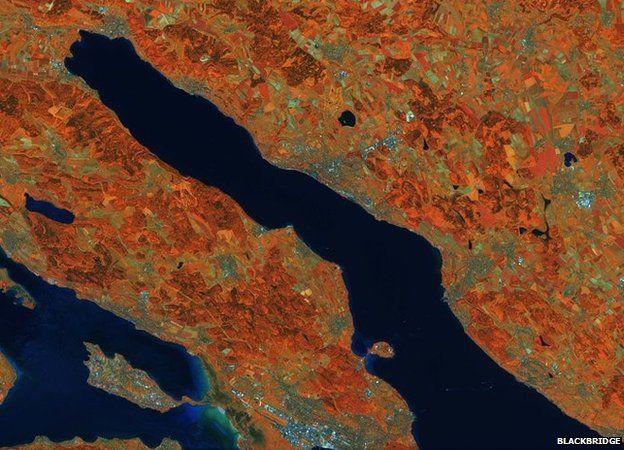
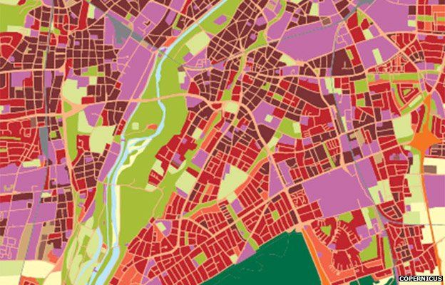
Satellite remote sensing: The business of making maps
Optical imagery can be used to make density maps for urban planning - in this case, Munich
Agriculture: Gathering crop statistics and yield assessments